
Arizona is just a few hours away from our home in San Diego, and we’re taking a road trip to ride dune buggies on the Algodones Dunes, visit Saguaro National Park and Agua Caliente Park, tour the Mount Lemmon Scenic Byway, and spend a few days in Sedona. And, since we are the King and Queen of shoulder season travel, we are going in the dead of winter (February).
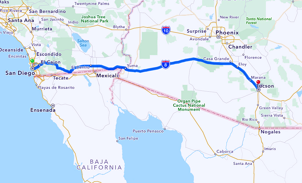
Road Trip from San Diego, CA to Tucson, AZ.
Pro tip: Normally in Southern California, we drive as fast as traffic will allow: stay in the herd, don’t cowboy, and you are unnoticed by the constabulary. This is NOT true on Interstate 8 traveling to Arizona. Set your cruise control to be about 4 mph over the speed limit, and relax.
Pro tip: Arizona is, let’s say “enthusiastic”, about enforcing traffic speed limits. You have been warned.
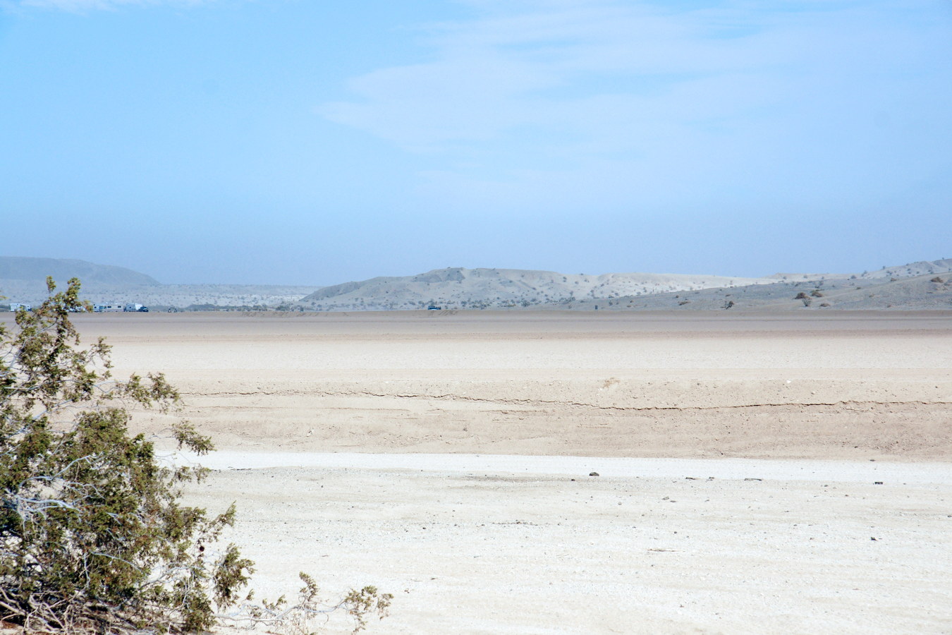
California Dunes near Arizona.
As you near the California – Arizona border on Interstate 8, you’ll notice you are driving past … nothing. And you’ll soon discover you are wrong.
Dune Buggies
There is, in fact, a large dune buggy community that takes advantage of the beautiful Algodones Dunes to enjoy their sport.
Note: the Algodones Dunes are split into different sections. Part of it is designated the North Algodones Dunes Wilderness and is off-limits to vehicular traffic. Of the section designated as Recreational, only 40% is open to off-road traffic.
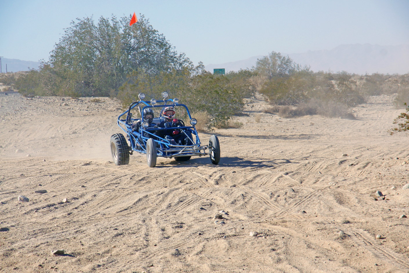
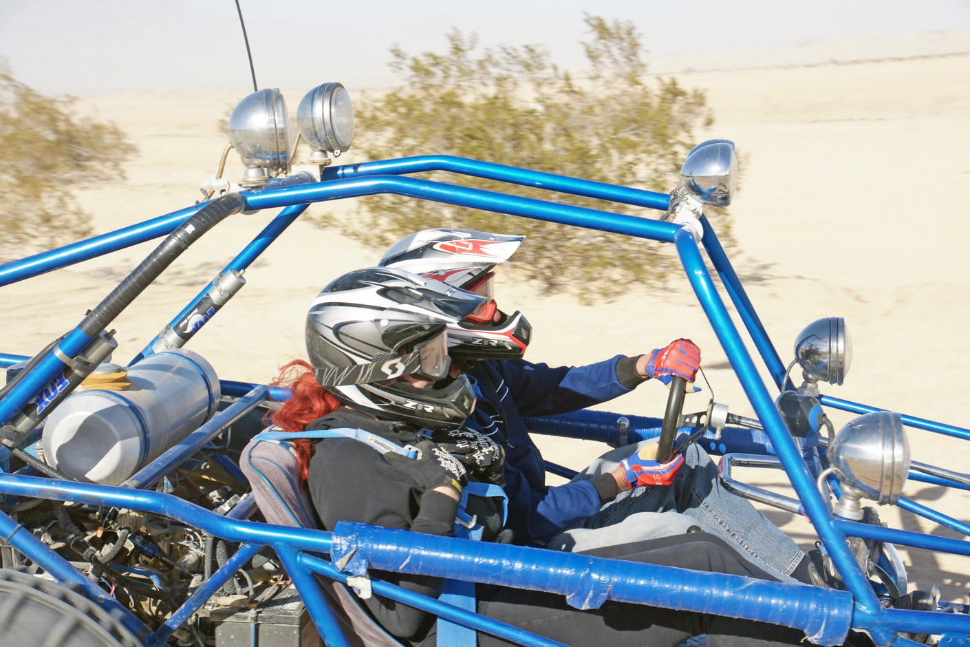
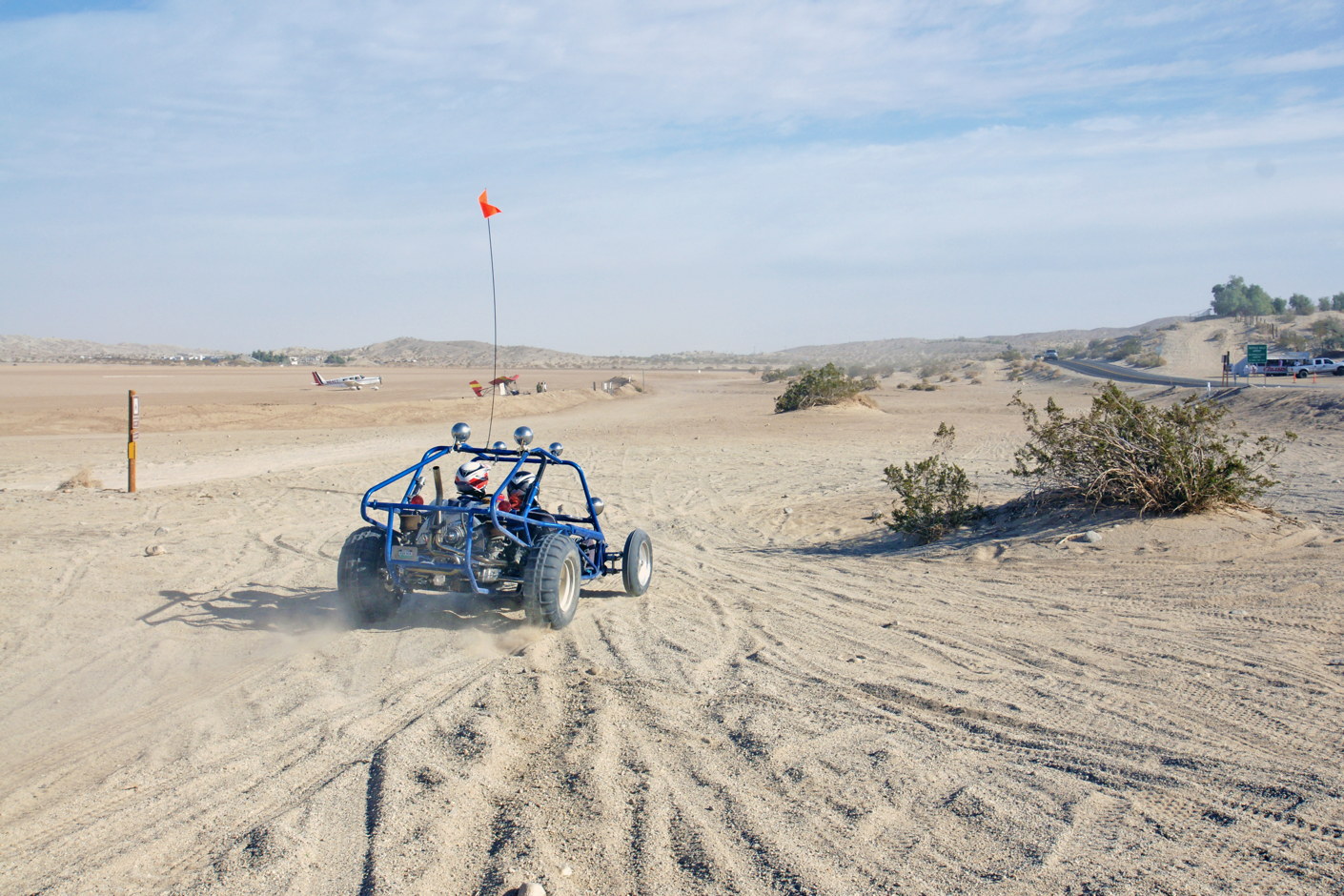
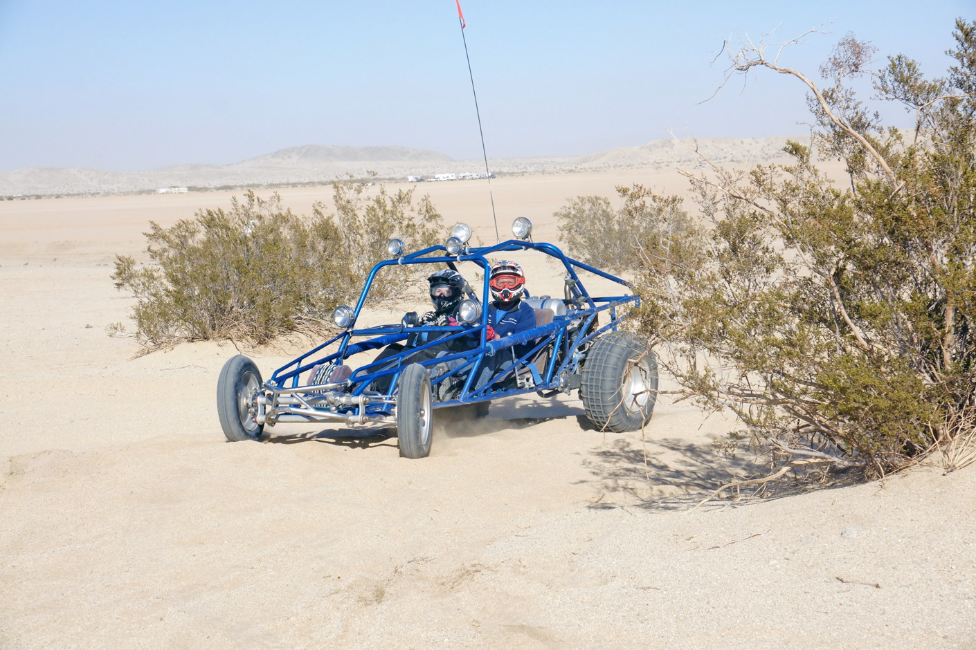
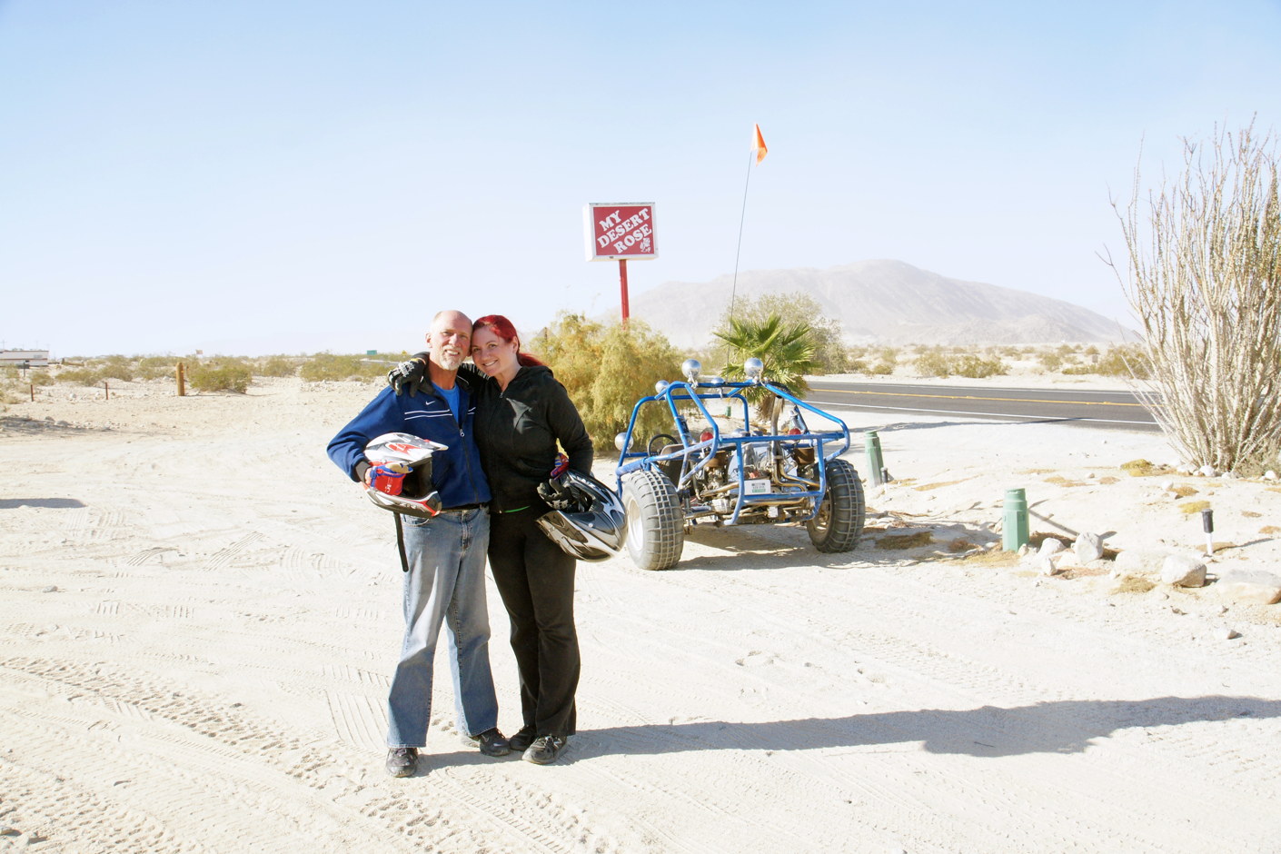
And that 40% is A LOT of fun. 😎
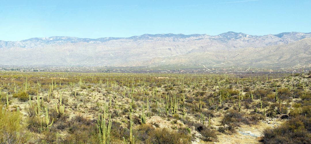
Saguaro National Park
Our next stop is Saguaro National Park, just outside of Tucson, AZ.
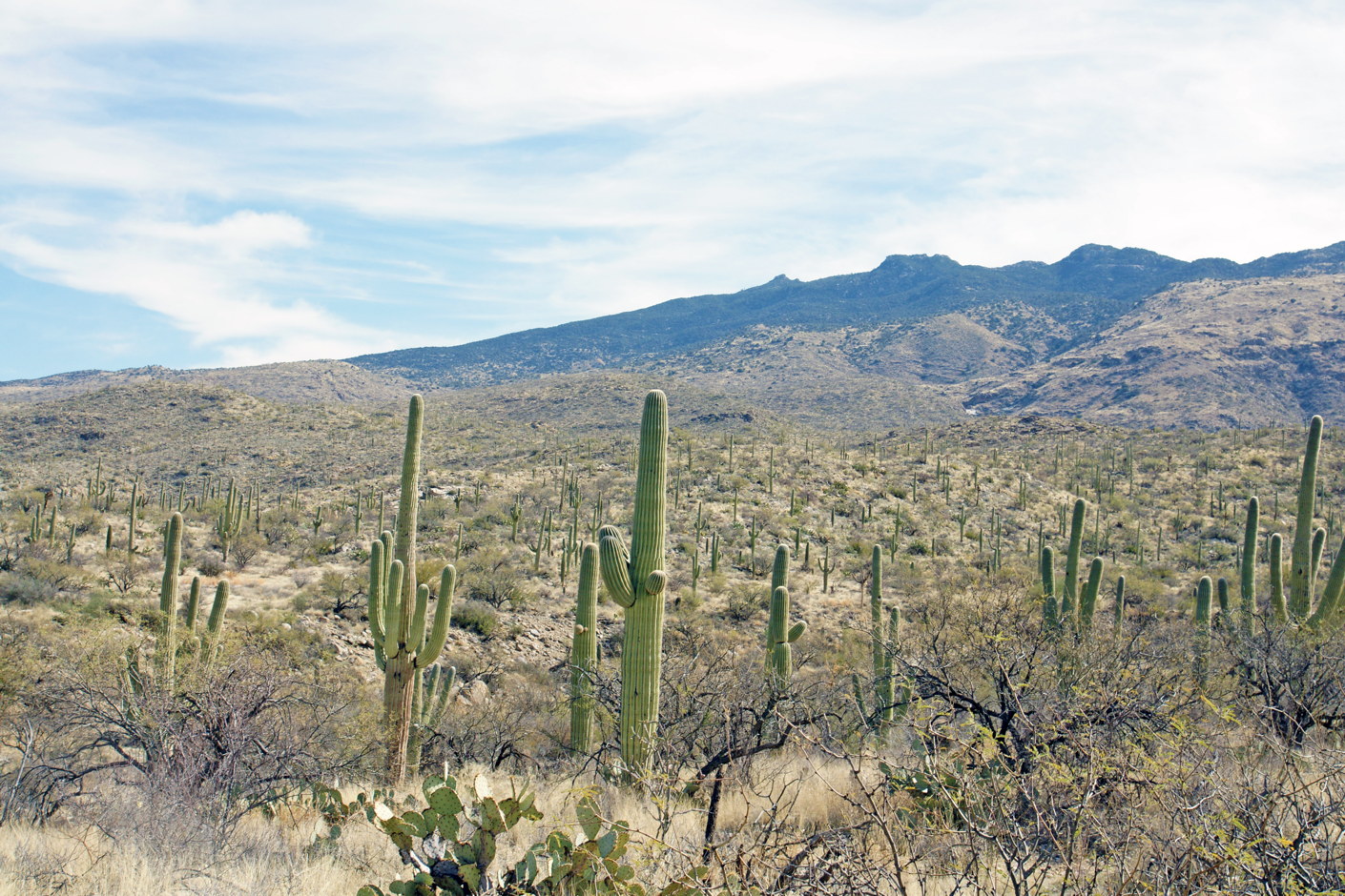
Saguaro cactus in Saguaro National Park.
The iconic saguaro cactus are in abundance well before you enter the National Park. They form forests, stretching across the undulating plains. In addition, there are about two dozen species of other cacti in this park.
We get out of the car and hike. The air is warm and everything is quiet. Except for a few small birds, we see no signs of animals.
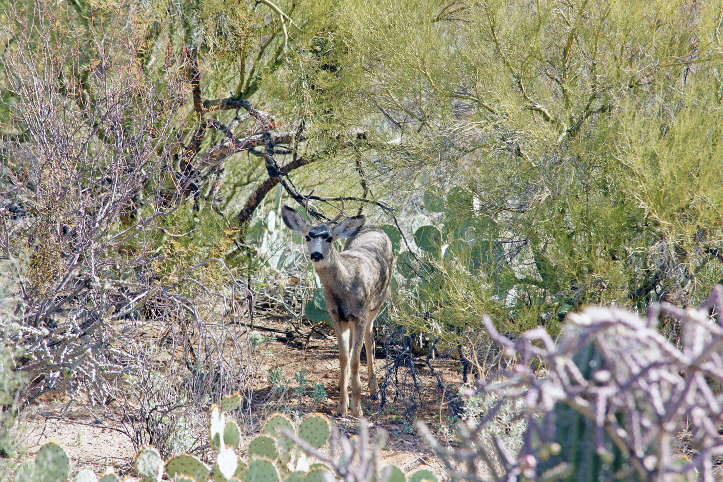
Mule deer hiding in a thicket.
After a short time, we spot a mule deer looking at us curiously. Note the Engelmann’s prickly pear cactus in front of and behind the deer.
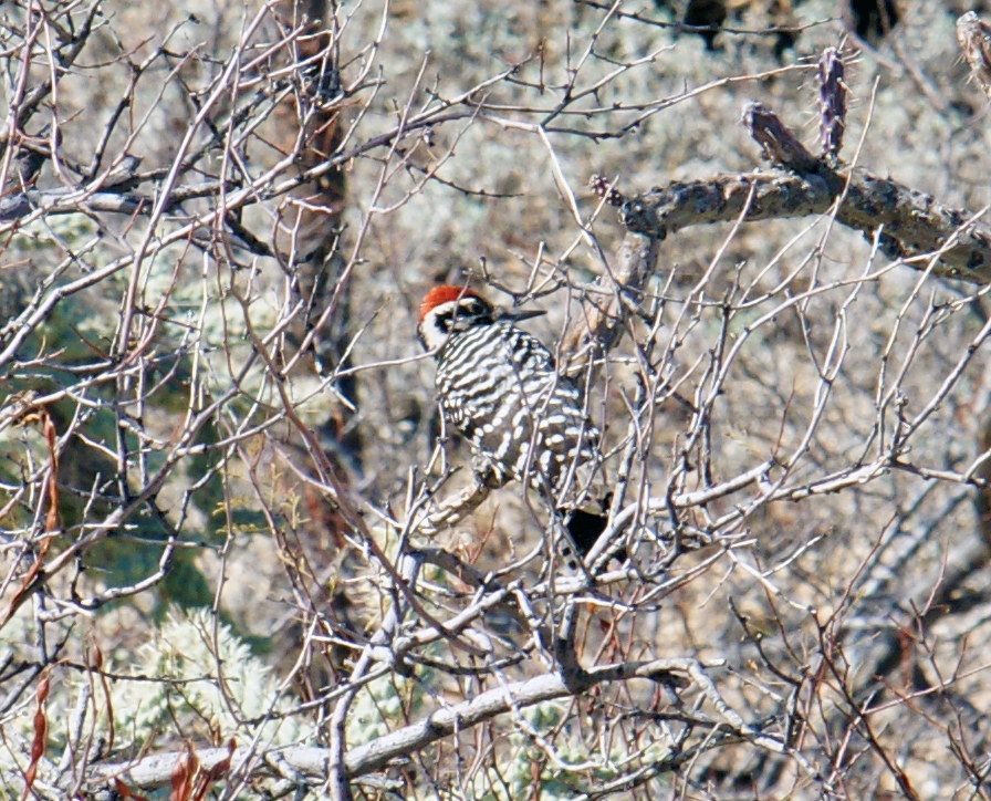
Nuttall’s woodpecker blending into the foliage.
Fortunately, the Nuttall’s woodpecker‘s splash of red on its crown makes it easy to see in the thicket of branches.
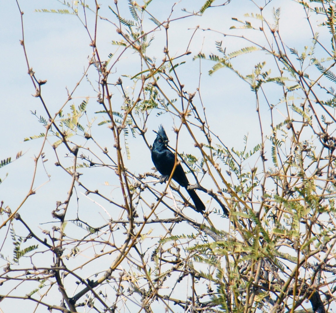
A male phainopepla, part of the silky-flycatcher family.
The Phainopepla stands out against the blue sky. Despite being part of the silky-flycatcher family of birds, feeds heavily on mistletoe.
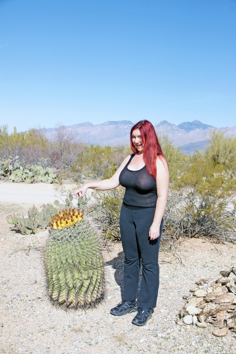
A fishhook barrel cactus with fruit.
Cactus abound in this park, and we find a fishhook barrel cactus that is flowering.
The flowers are pollinated by cactus bees. Mule deer, birds, and javelina eat the fruit. The birds especially like the seeds. The people of the Sonoran Desert use the fruit for candy and jelly.
Tradition says that the barrel cactus is a source of water for people lost without water in the desert, but the water contains oxalic acid and is likely to cause diarrhea if ingested on an empty stomach.
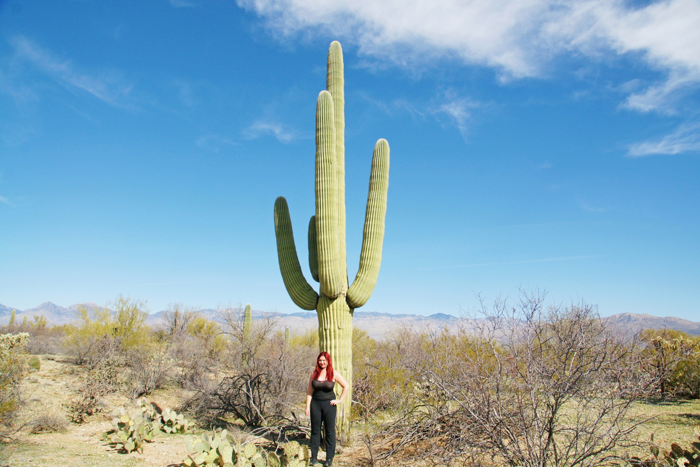
Saguaro cactus, when fully hydrated, can weigh up to 4800 pounds.
However, it’s the saguaro that draw our attention. When you get close to the cactus, you can see how big they really are. Interestingly, most of the saguaros roots are only 4-6 inches deep and radiate out as far from the plant as it is tall. There is one deep root, or tap root that extends down into the ground more than 2 feet. This root system allows the cactus to quickly absorb any rainfall, and it is also responsible for keeping saguaro cactus distant from each other.
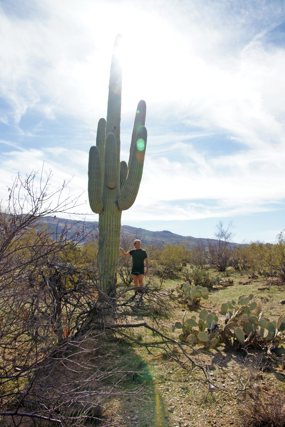
A saguaro cactus over 25 feet tall.
Despite the seeming harshness of this environment, there is a softness if you spend the time to explore. But our excursion has ended, and we continue to the next.
Agua Caliente Park
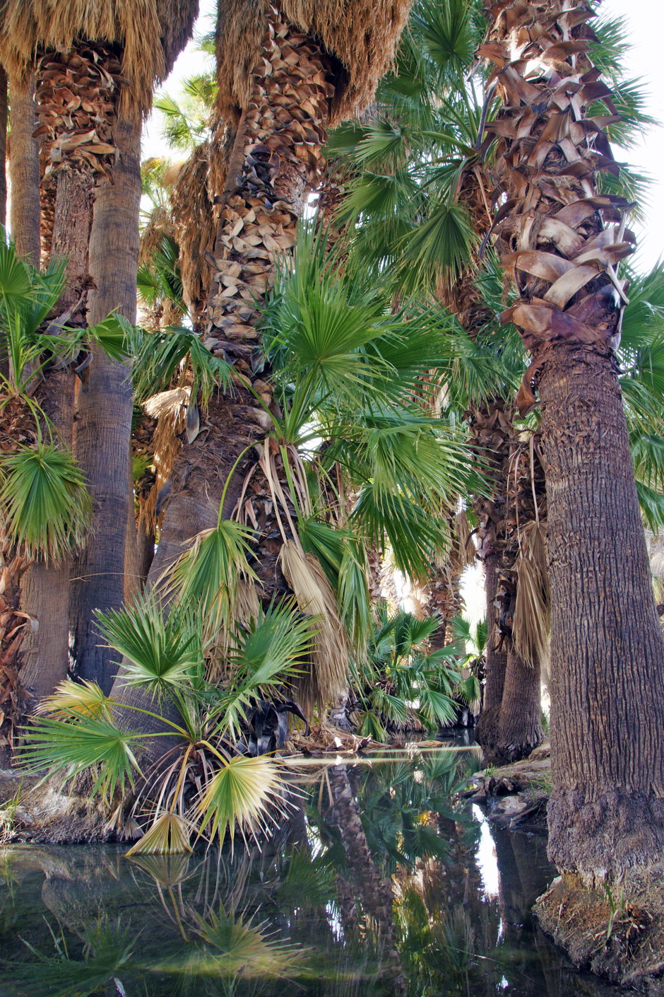
Agua Caliente Park, or more formally Roy P. Drachman Agua Caliente Regional Park, is a 101-acre park with a perennial warm spring. It is located on the far east side of Tucson, and that is our next destination.
The waters of Agua Caliente Park provide shelter from the desert heat.
The air in the park is remarkably cool, even though the name means “hot water”. The park is nearly empty on this February morning, and we are enjoying the solitude. A pair of mallard ducks in winter plumage swim past us.
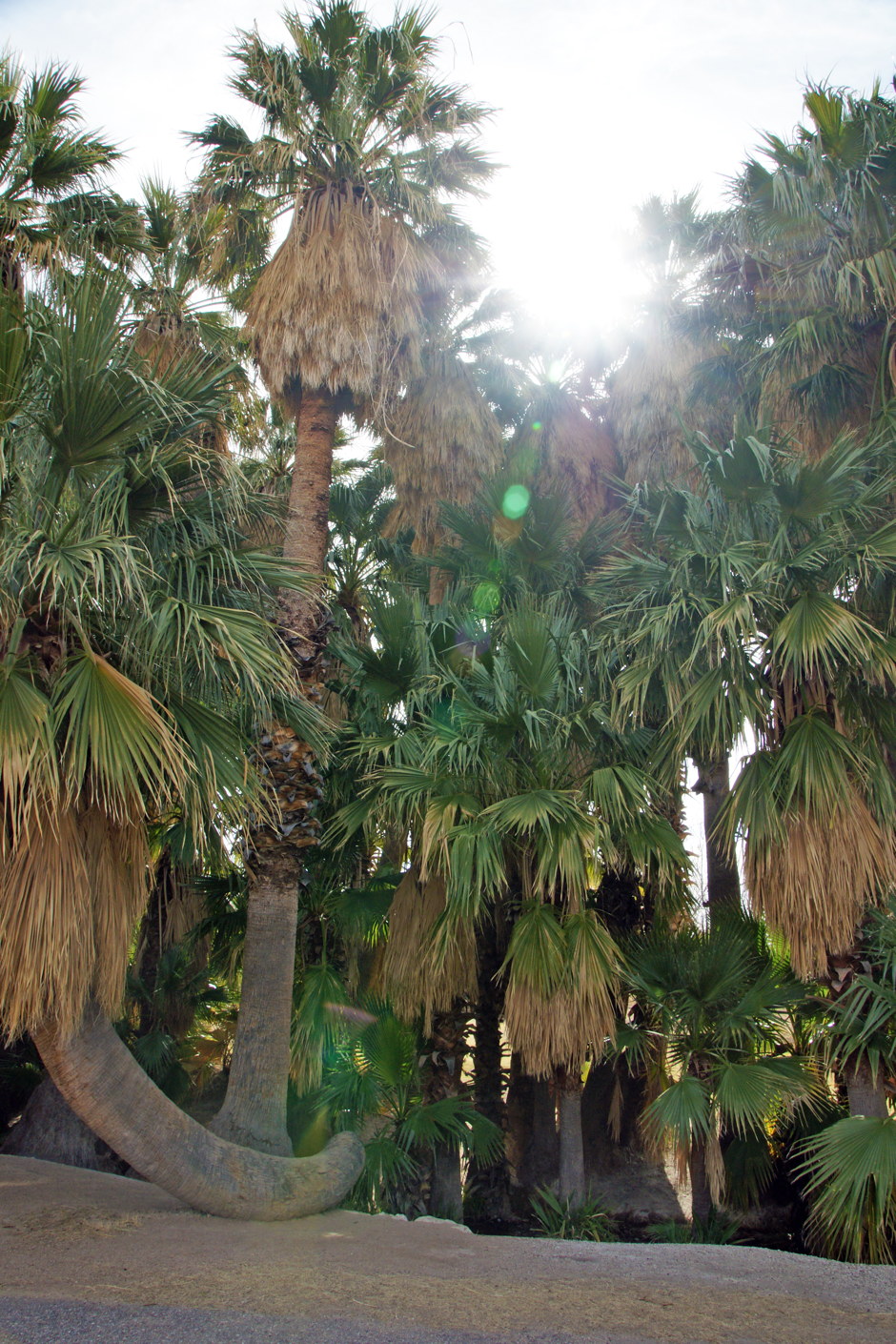
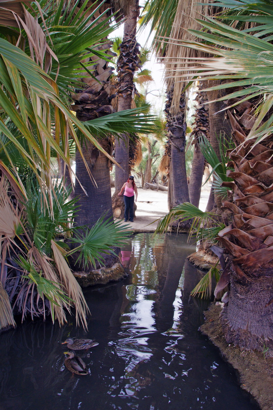
One of the unusual palm trees of Agua Caliente Park.
The park is home to many different species of palm trees, creating a small forest of trees. The shaded areas are as cool as they appear to be.
An oasis in the Arizona desert.
This place is reminiscent of Hollywood’s portrayal of the thirsty desert, the only salvation being a rare oasis with no human inhabitants. Except here today, it really is. 😎
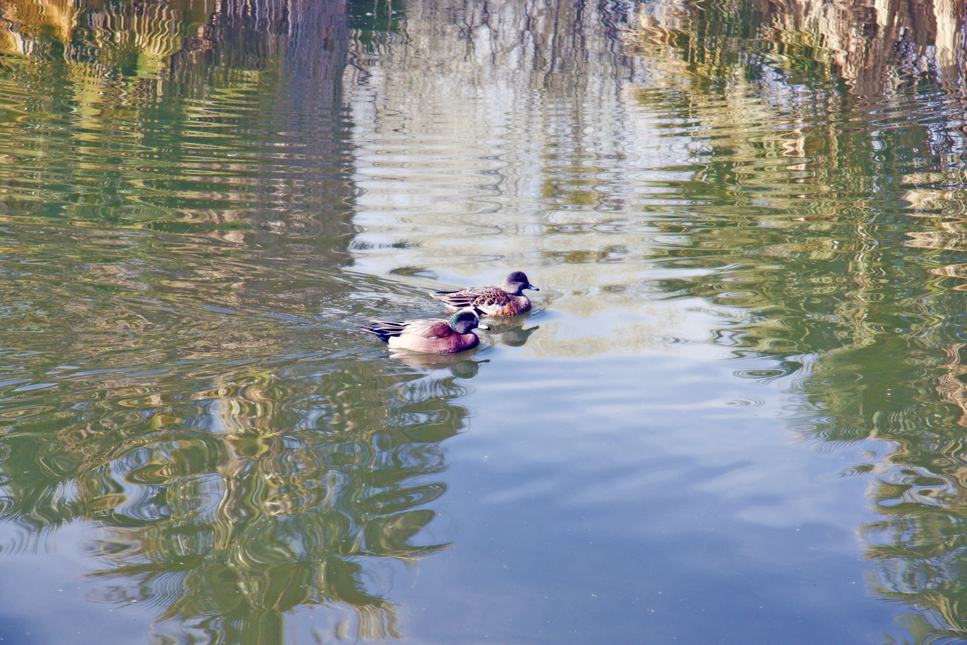
Some of the wildlife hosted by Agua Caliente Park.
As we anticipated, Agua Caliente is home to hundreds of different bird species, but the easiest to see are the ducks, especially these american wigeon.
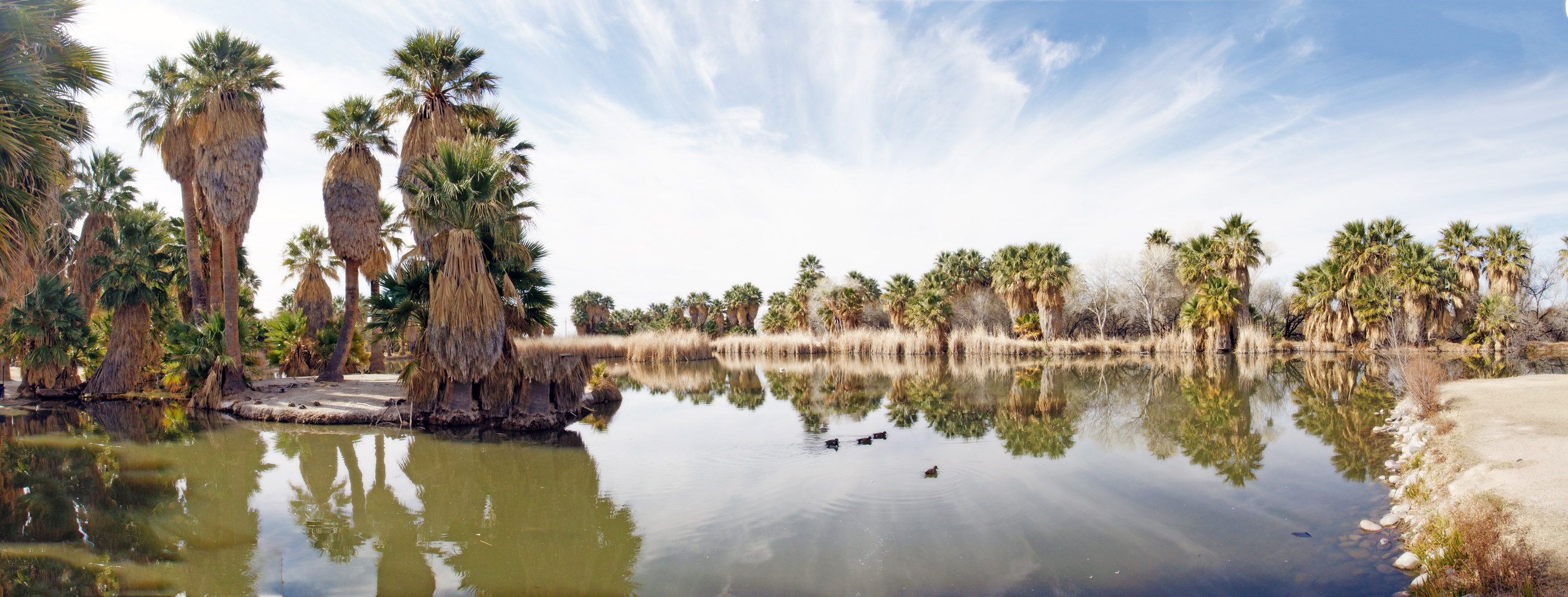
A panoramic view of Agua Caliente Park.
According to the park’s website: “The flow rate from the spring has varied over time reportedly as high as 500 gallons per minute to an unmeasurable seep in recent years. The sources and pathways for the water that now infrequently comes out of the natural spring head are not fully understood. Rainfall and snow on the Santa Catalina Mountains, shallow and deep rock stresses and fractures as well as significant heat generated hundreds of feet below the surface, all contribute to the complex and changing system. In recent years the pond has been maintained with water pumped from a well located on the property.”
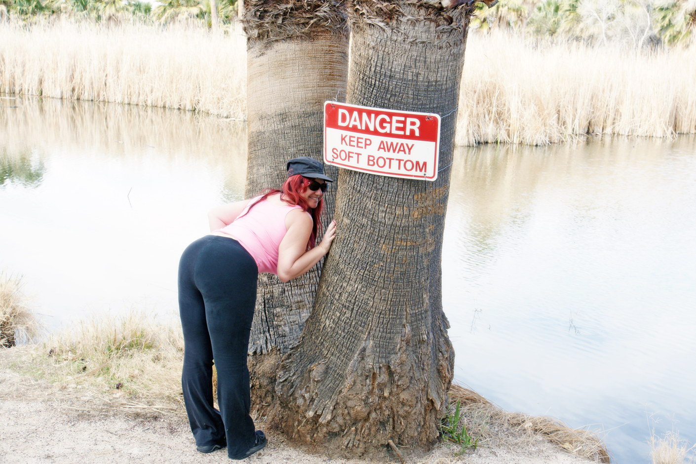
Warning: Soft Bottom at Agua Caliente Park!
Danger: Bad puns ahead. We have seen the park from the front side to the backside (sorry) and are at the end (sorry) of our visit and we don’t want to fall behind (sorry), so we will jump in our car seat (sorry) and high tail (sorry) it to our next destination,
Mount Lemmon Scenic Byway
We have a good night’s sleep at a small hotel, then get back in the car and drive north on the Mount Lemmon Scenic Byway, a 27-mile long stretch of highway that runs from Tucson to Mt. Lemmon.
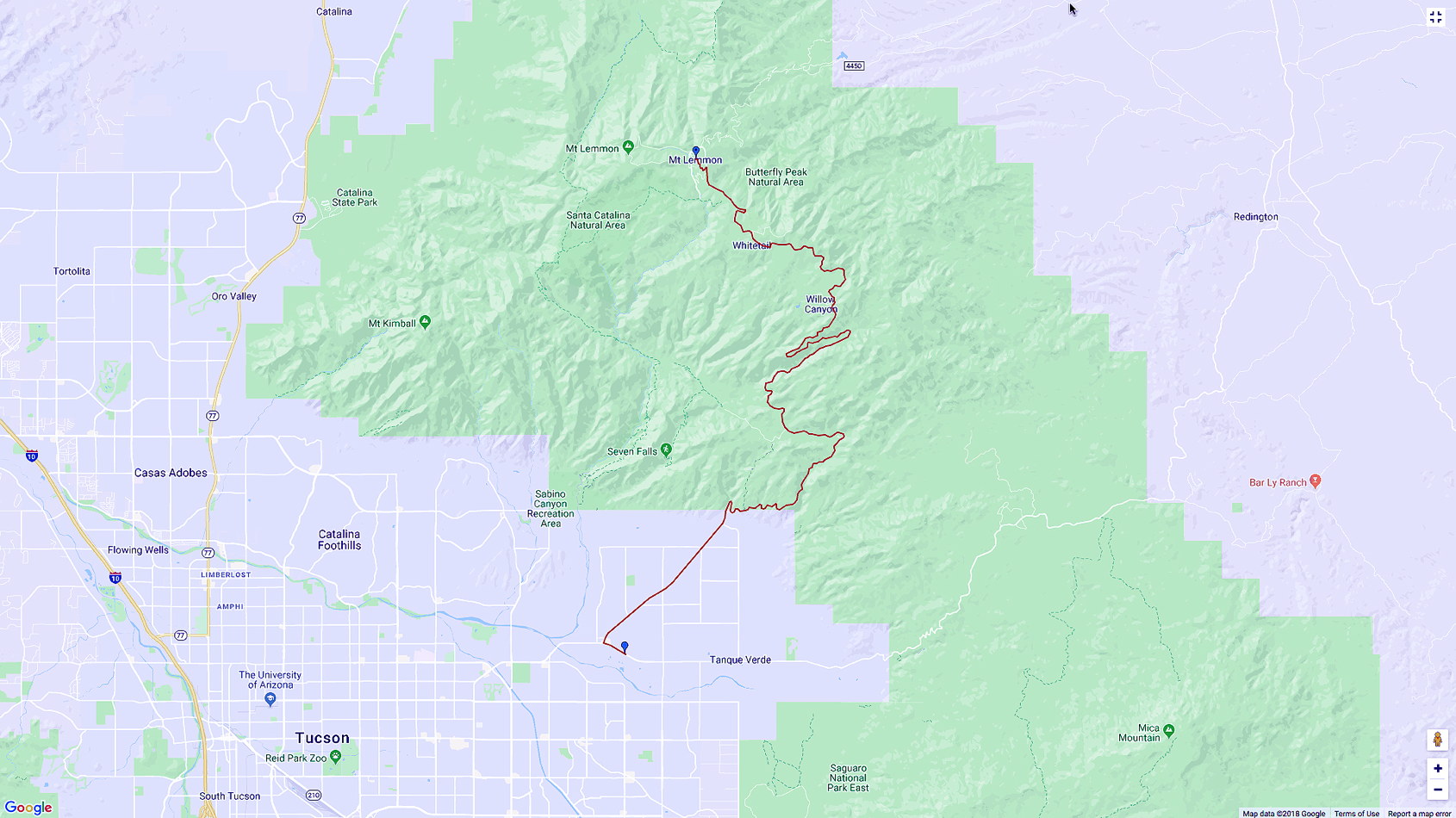
Mt. Lemmon Scenic Byway Route.
We drive slowly, not only because the road is tortuous, but because we don’t want to miss any of the spectacular scenery.
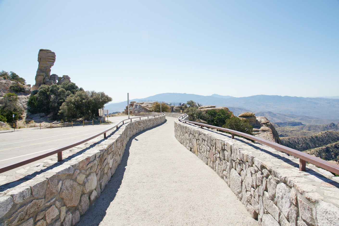
Mt. Lemmon Scenic Byway viewing area.
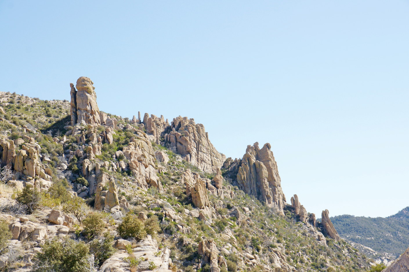
The state of Arizona has kindly provided a number of turnouts at prominent locations, and we avail ourselves of them. At the end of this turnout is a viewing area on a raised rock formation. Notice the hoodoo to the left, one of the many such formations in Arizona.
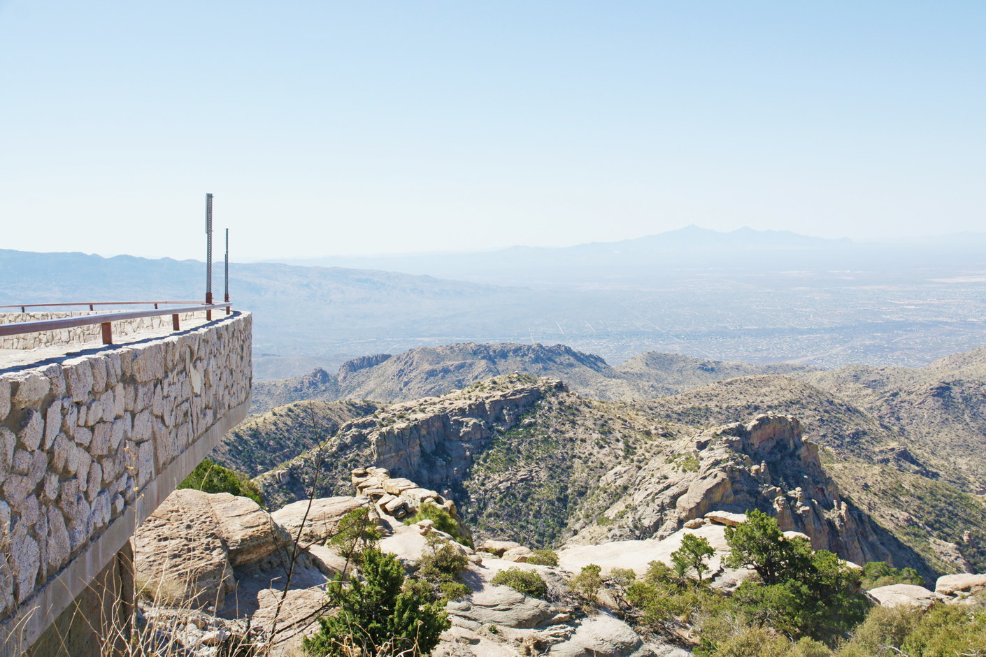
The roads in the town below are visible through the haze of the desert air.
The view is spectacular. We take our time; each outcropping of rock has something beautiful to share with us.
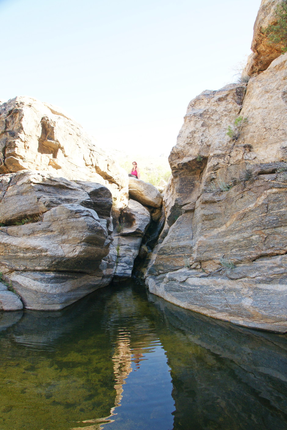
Time for reflection….
We leave our car and hike down a path towards a copse, because we know that, in the desert, trees mean water. And sure enough, we find a cool pond.
Relaxing on an island in Arizona.
There is no one but us here, and the gurgling of the stream is the only sound.
Rock formations along the Byway.
We continue our drive, impressed that something as simple as “rock formations” can have such majesty.
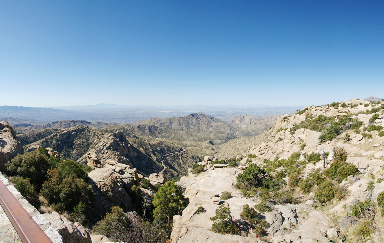
The view south from a viewing area.
We stop at another turnout and can see the route we have been driving. We can easily see the different types of rocks, just in that the formations directly below are smooth, indicating sandstone.
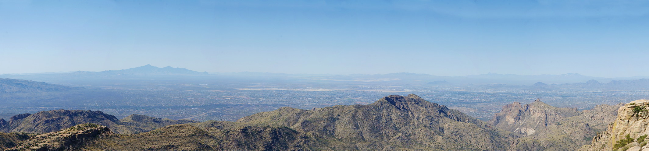
A panoramic view from Mt. Lemmon Scenic Byway.
We love the southern Arizona desert, but it’s time to continue our adventure.
Sedona
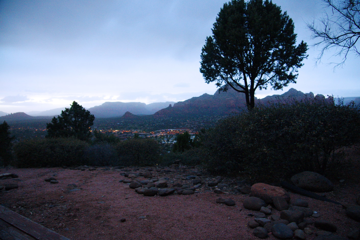
We are in Sedona, staying at the Sky Ranch Lodge, an unpretentious hotel near the Sedona airport and overlooking the Oak Creek river valley.
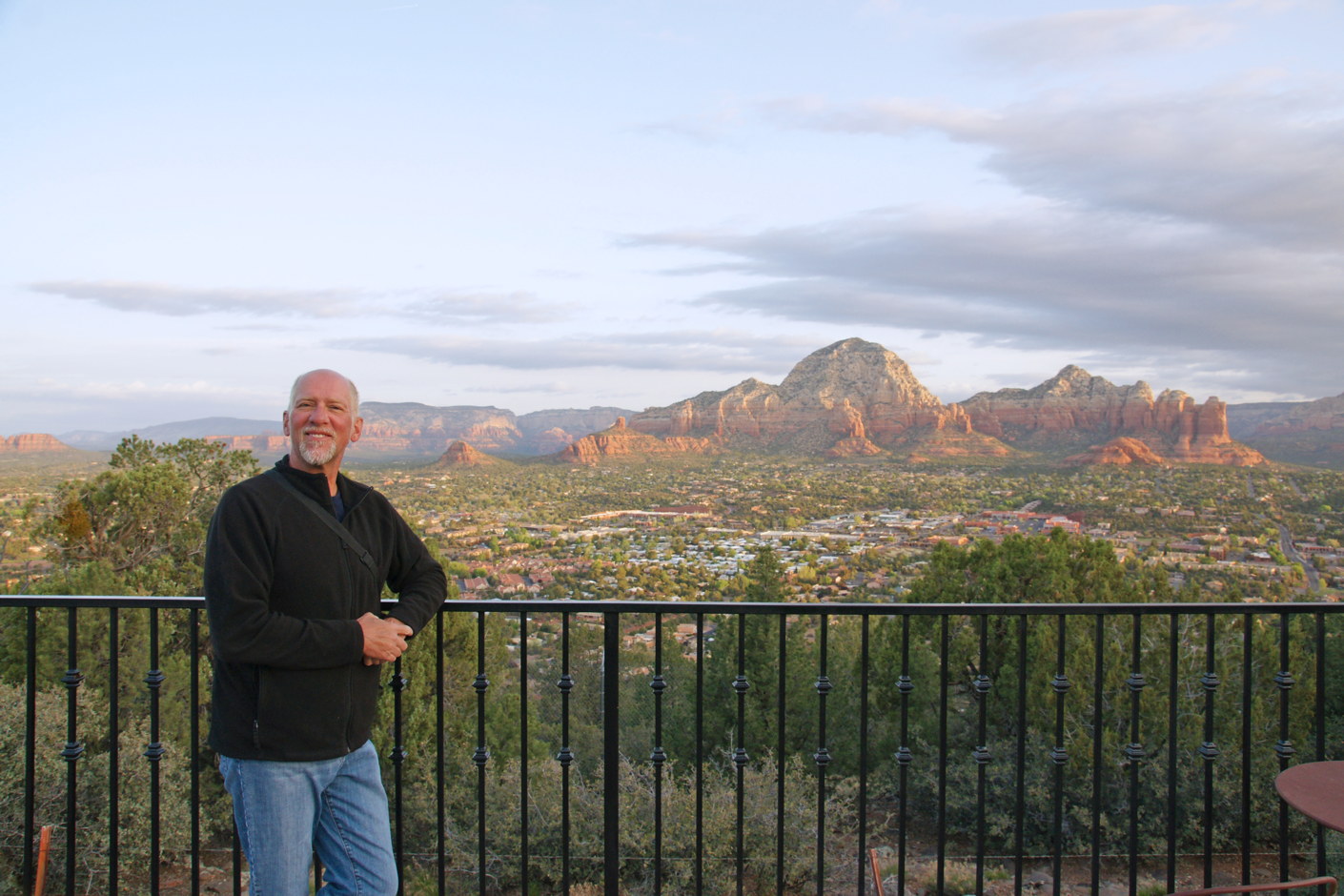
A view from Sky Ranch Lodge.
We are staying at this lodge because of the view across Oak Creek canyon.
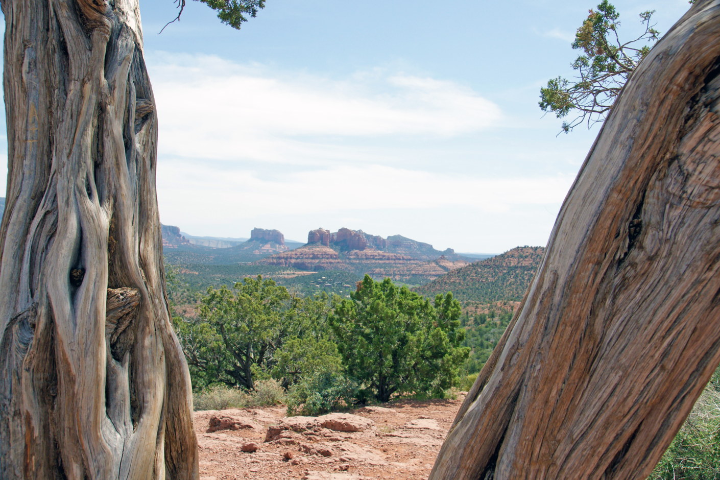
Picturesque Sedona.
But we are here to hike, and hike we shall. Given that it’s February, there are almost no other hikers around, and we enjoy the solitude.
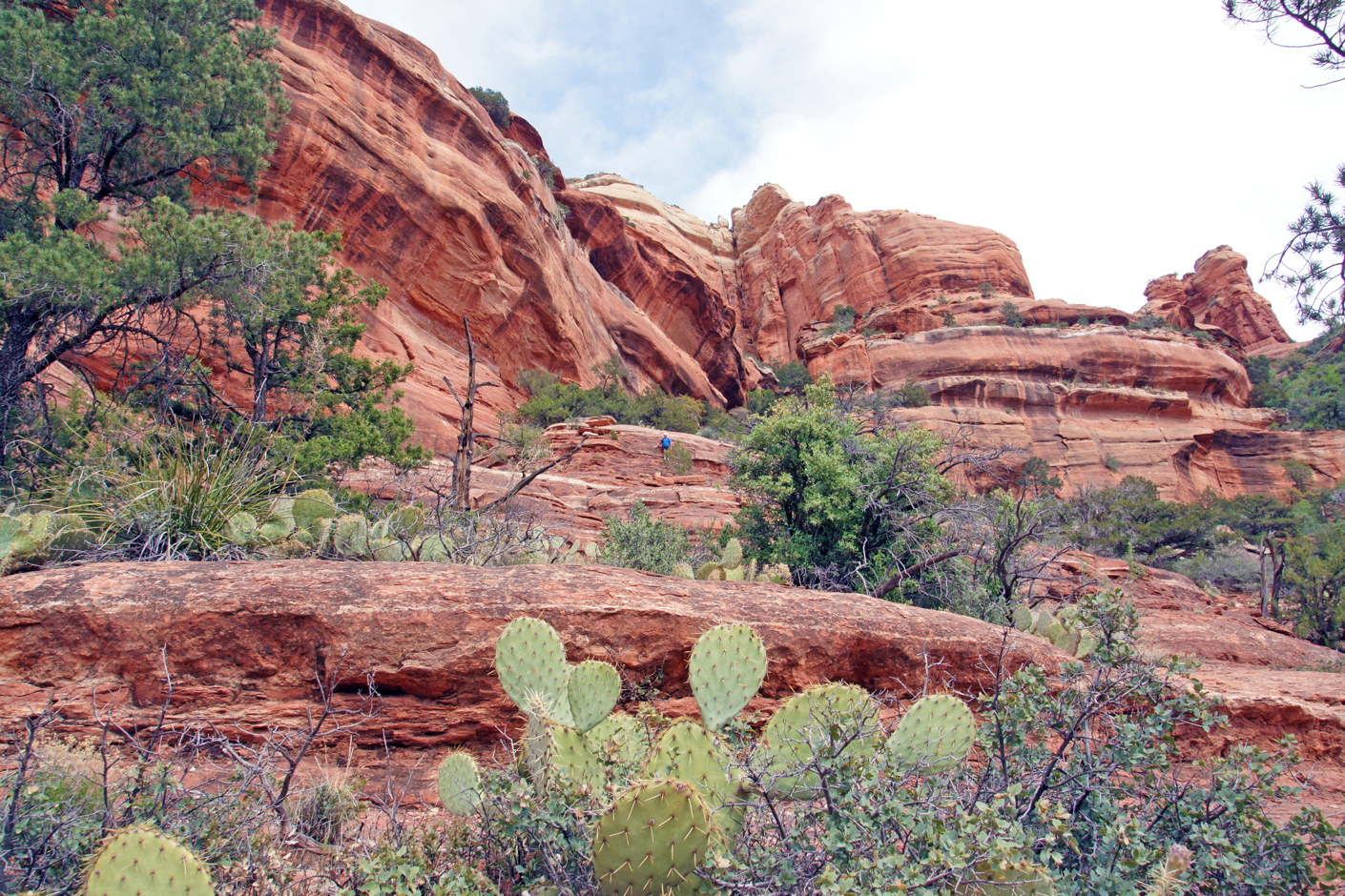
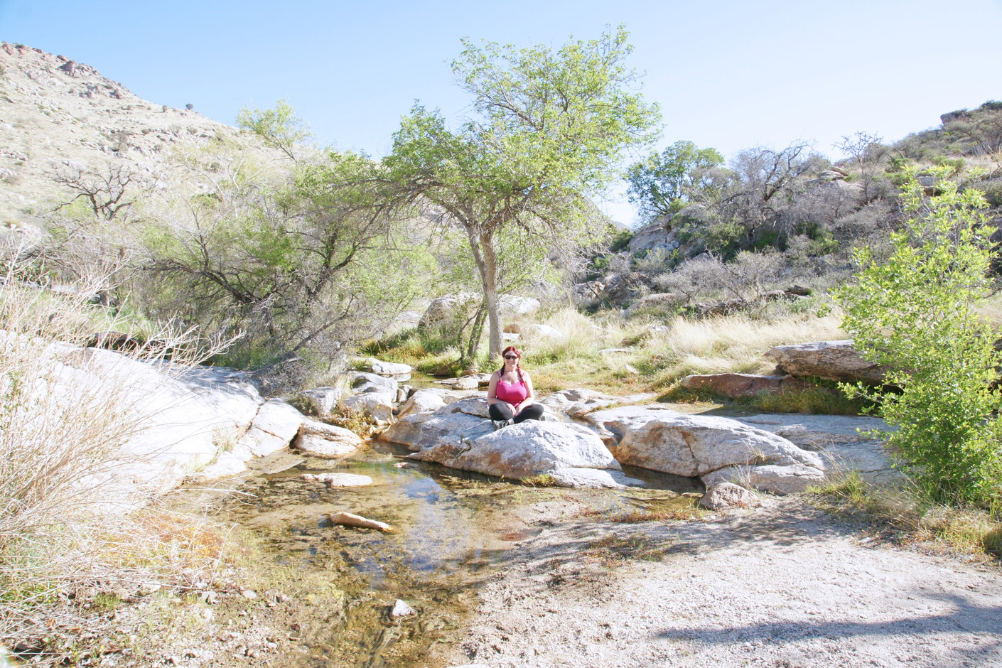
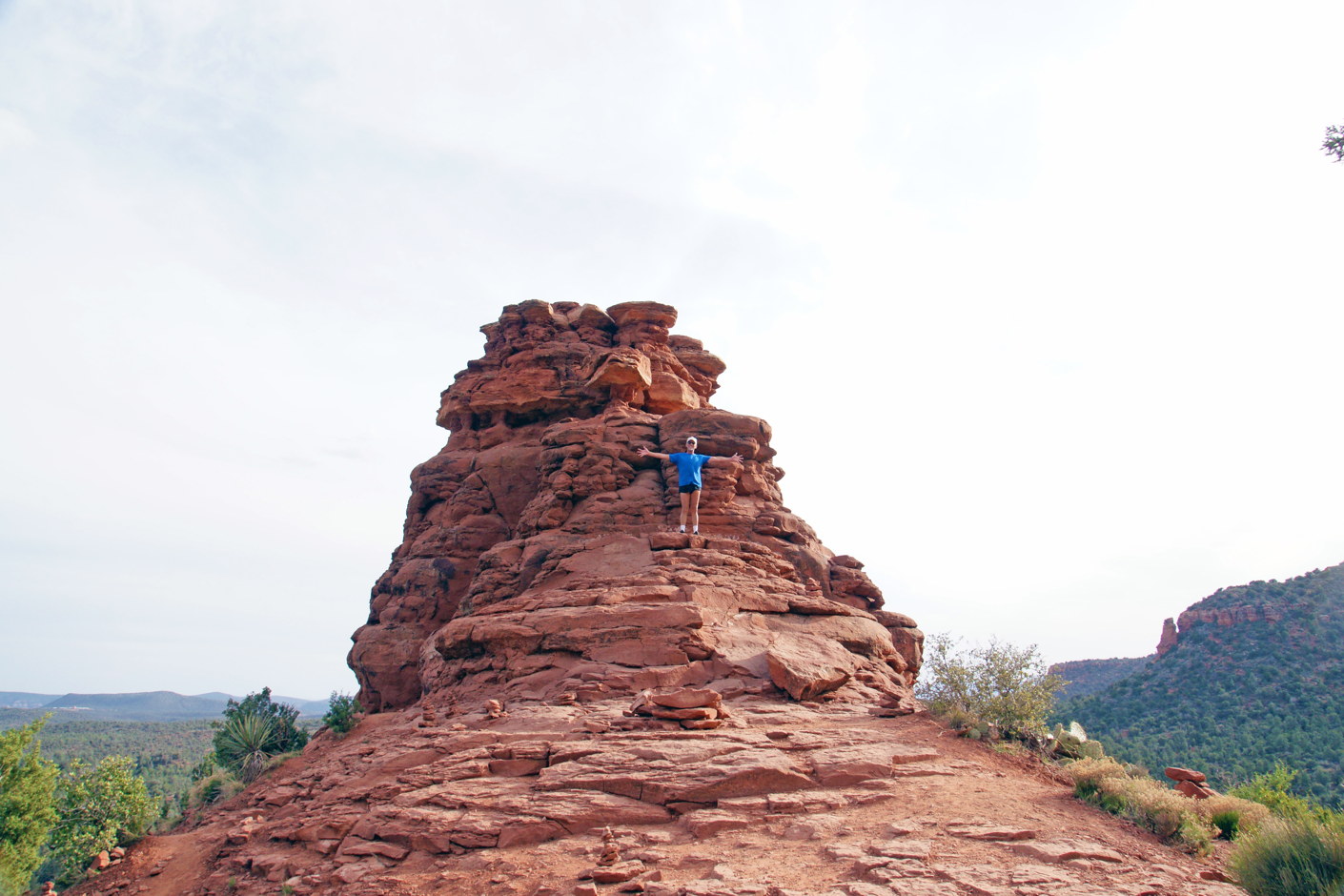
The little speck of blue in the center is me.
The red rock is not slippery, and we climb pretty much anywhere we like. The air is crisp and clean.
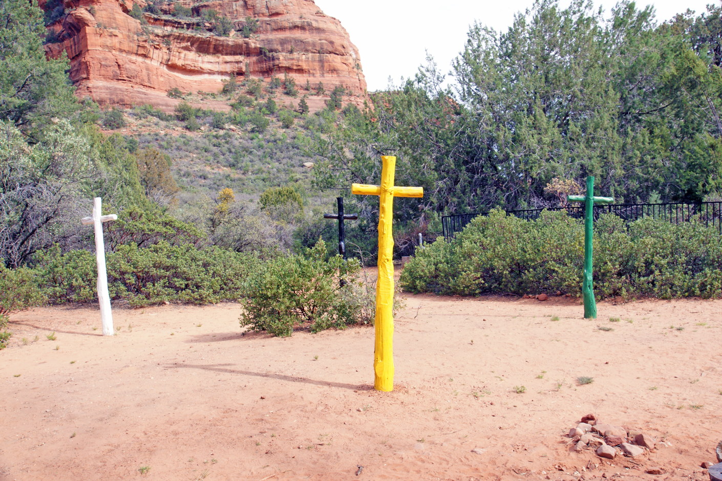
Four crosses on a trail.
A hiking trail leads to these four colored crosses. We have no idea what they mean, but they are a convenient trail marker.
Wheeeeeeeeeee!
Okay, I like to climb things. The day is warming, and we are enjoying having the place to ourselves.
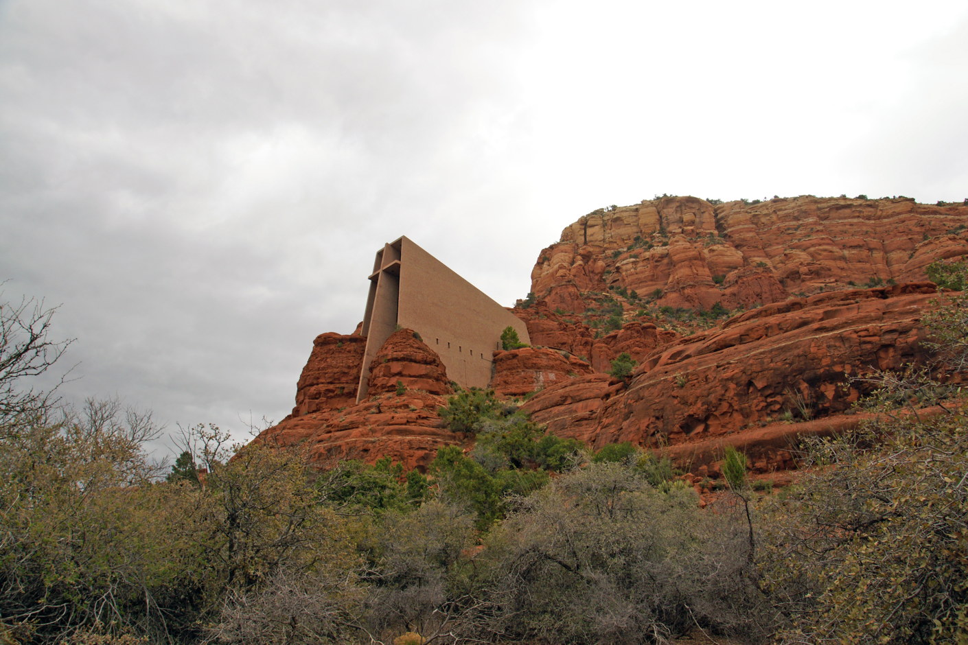
The Chapel of the Holy Cross.
The Chapel of the Holy Cross, one of the seven wonders of the world. Well, seven man-made wonders. Of Arizona. (True!) It is an interesting mixture of natural rock and human architecture. We hike to it, but the inside is rather small (and we are not sure if photographs are allowed); the outside is far more interesting.


We take far more photographs than we can reasonably show in our travel blog, but we’ve included a small slide show of some of the more interesting shots we took.
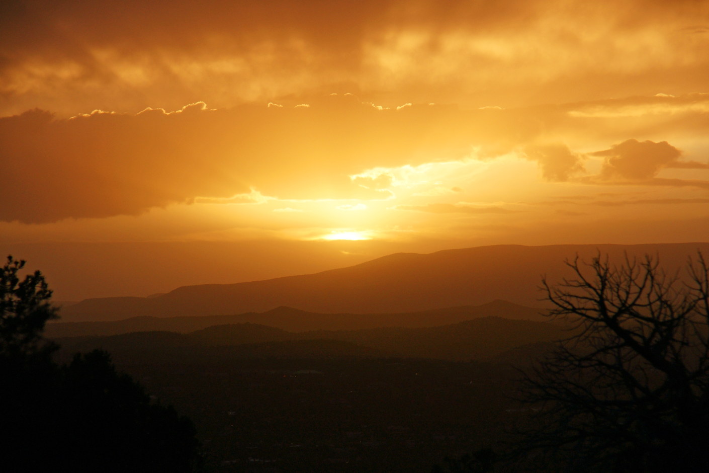
Sedona sunset.
The sun is setting, and, like everything else in Sedona, it is beautiful.

Enjoying the cool Sedonan evening.
We return to our hotel. There is a television, but why would you watch TV when you have Sedona?
The view from our porch in the evening.
We sip wine and enjoy the night, stargazing from our patio, watching the satellites and shooting stars in the cool night sky. After a while, clouds blow in and the night becomes too cool; we retire to our bed.
Snow in Sedona!
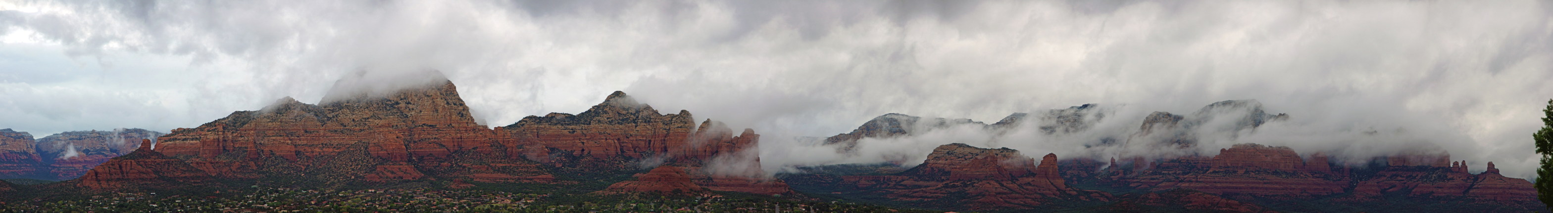
Ominous clouds over Sedona.
We awake the next morning to begin our journey home, and discover that a storm has moved into Sedona overnight. We bundle up and drive though the valley, then out the other side.
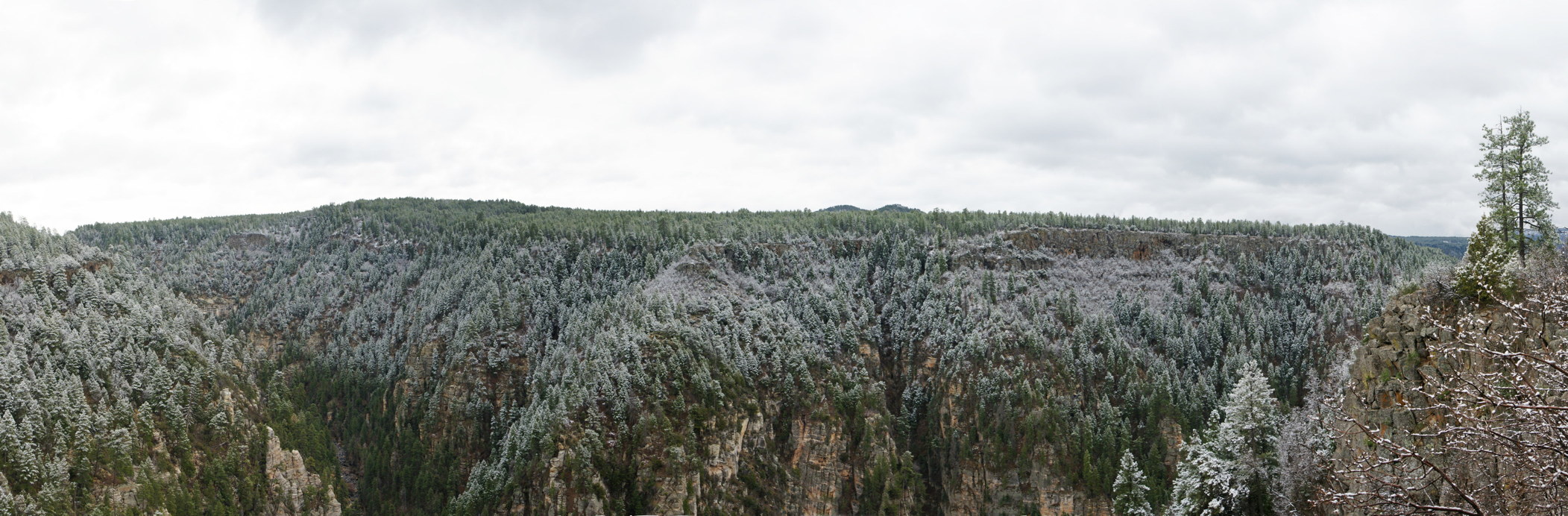
Snow in Sedona!
Snow! For us, this is quite a treat. San Diego doesn’t get snow. For us, a cold day means the temperature never reaches 70 degrees. This is fantastic!
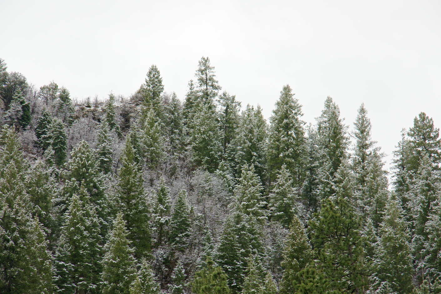
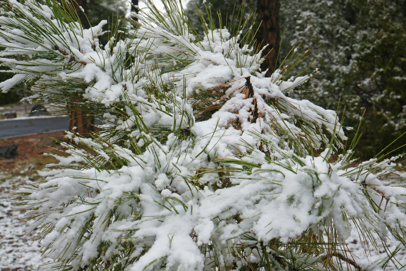
Snowy Sedonan tree-tops.
The trees are lightly dusted with snow from the night’s storm.
Snow!
We park the car and walk through the wooded hillside, enjoying both the brisk air and the white fluffy snow.
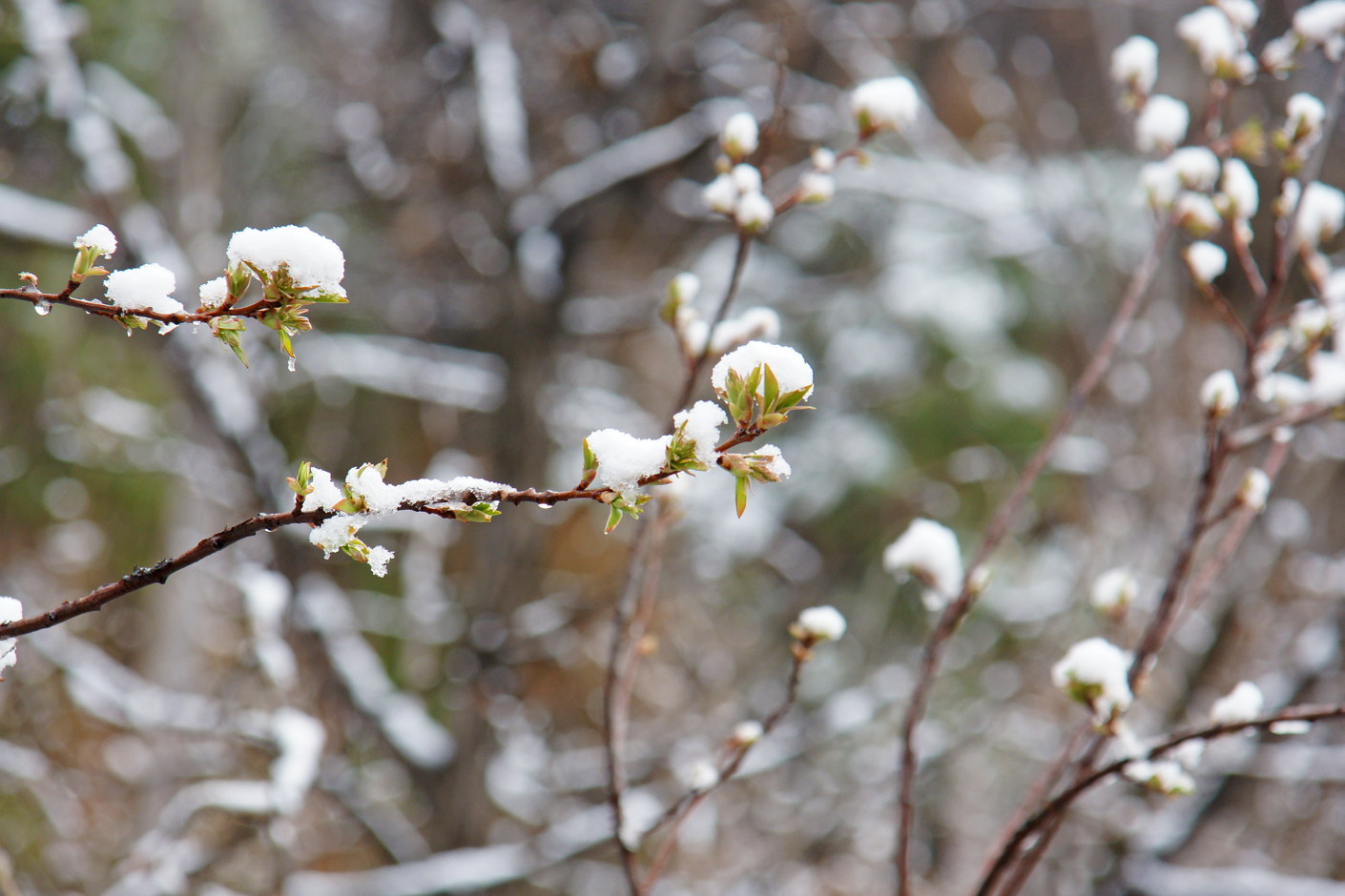
The snow is already beginning to melt.
There is beauty in transience, and the slow drops of the melting snow serve to bring more wonder to the moment.

A treat for southern Californians.
So our road trip ends. We began with dune buggies and desert cactus, transition through a warm lake and scenic mountain byway, then hike the red rocks of northern Arizona and frolic in unexpected snow. Television teaches us that the desert is a desolate, hot, uninhabitable place; in fact, the Arizona desert is diverse in landscape and weather, and is waiting there for your enjoyment.
May all trips be such fun! 😀